Not everyday you get a chance to sip your Americano while looking out towards one of the most heavily militarized borders on this planet. Like always one thing led to another and we were on our way to South Korea for a family holiday. South Korea had been high on the list for TW (The Wife) for a while, mainly due to food. For me, it was the attraction to DMZ (De-Militarised Zone) which was top on the agenda, having read over 15 books about North Korea in the last decade. TD (The Daughter) is always happy to hop on a plane, more so after she joined me in maintaining records of her airports and airlines. So South Korea it was!
Things don’t always go as per plan, but we are prepared to plan on the go and this trip was no different. There are multiple options to visit the DMZ. The most popular is the JSA or the Joint Security Area. It has always been one of my dream destinations, because you technically step into North Korean land here. The JSA remains closed now, after an American soldier crossed into North Korea, yes an American into North Korea. While I have read so many books of people who crossed from North into South, there is no book by any one who did the opposite. Multiple tours were explored, each site researched in detail and the conclusion was that we do not want to take a group tour (like always) and that I will do a better job of being a guide for TW and TD. Decision made, we should visit the border at the Starbucks cafe, a unique outlet within the DMZ overlooking North Korea or let’s go by its official name, the Democratic People’s Republic of Korea.
Our day began early, in Myeongdong, the heart of Seoul with the usual breakfast on the 19th floor of our hotel with a partial view of the Seoul tower. The streets were alive with the morning commuters and public transport buses lining up at bus stops. We booked a private taxi for the trip North, roughly 50 kms or about an hour and a half drive depending on the traffic. It eventually took two boring hours in traffic, crossing one suburb after another and bridges which had become familiar by then. As we started getting close to the DMZ, a sense of familiarity crept in. It was as if the books were coming alive and I knew these areas. Flood lights pointed at the river, barricades on the river, occasional military convoys with soldiers gazed at anyone and everyone on the road and looking for possible people in the river, watchtowers at regular intervals, guarded by armed soldiers and no photography signs all around. A constant reminder that the Korean peninsula is at war, technically. The thought of clicking the photo of the “No photography” sign took a backseat for the fear of “click” being responded with “bang”.
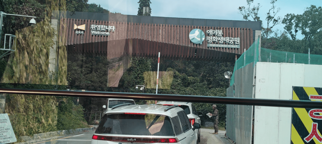
Soon, we approached the Aegobong Peace Ecopark. I don’t know why they have “peace” in its name, but this place is right in the DMZ. There is nothing like Demilitarised here since there is a continuous presence of armed personnel and vehicles all around. We were stopped by two such armed guards and directed to the parking lot for cars, which led to the ticket office and washrooms.
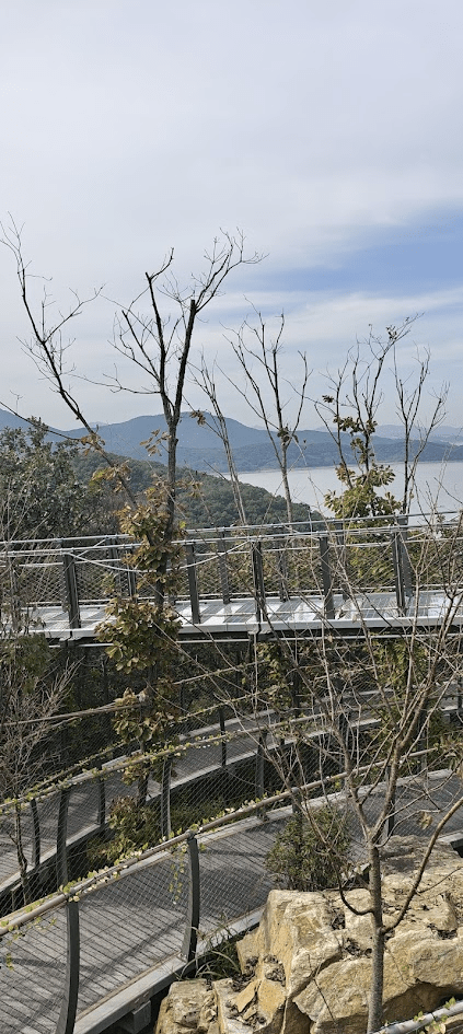
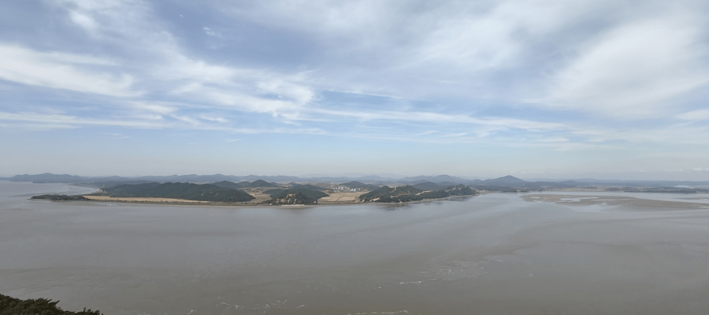
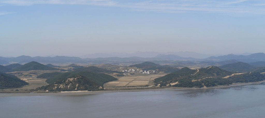
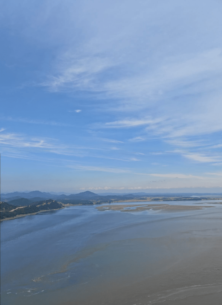
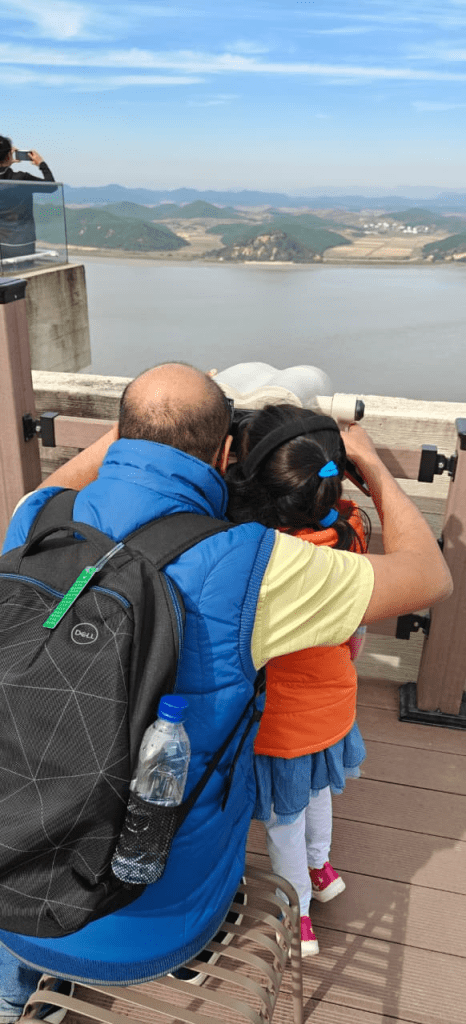
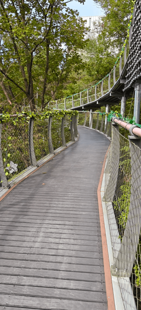
The first question at the ticketing counter was Nationality, followed by checking of the passports. There were no questions asked for Indian passports. We were soon guided to a bus that would take us to the observatory, but not before the armed soldiers entered the bus for a check. The shuttle bus made its way via winding road to the parking area which hosts the Aegobong Peace Park exhibition centre, which also gives a first glimpse of North Korea. A combination of a hanging bridge and a winding pathway help cover the remainder of the distance to the edge of South Korea, overlooking the Han river. As we took the last steps towards the heights of the park in the cold weather, the unmistakable green mermaid logo of Starbucks was in view and a look on the other side, it was the DPRK. Having grown up reading books, tracking geopolitics and with immense interest in geography, there are few places which I have visited which I never believed I could when I first read about them. The leaning tower of Pisa, St. Basil’s cathedral in Moscow, the Berlin wall and now the view of DPRK. The first thing you see is the Jogang river, which acts as a natural boundary between North and South Korea. When the war ended, the 38th parallel was to act as the dividing line. However, that was not to be as an actual boundary was worked out later.
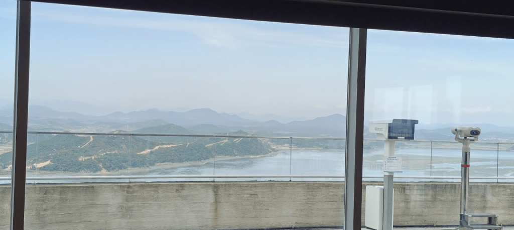
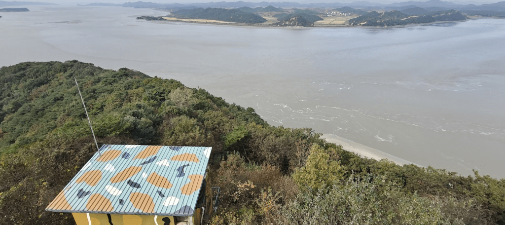
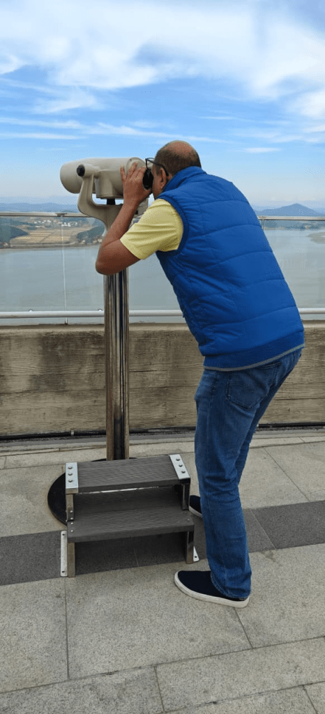
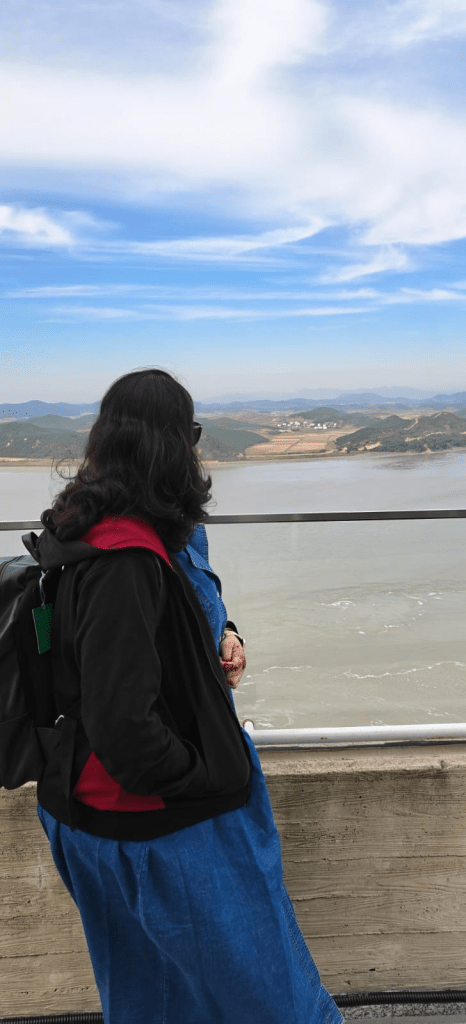
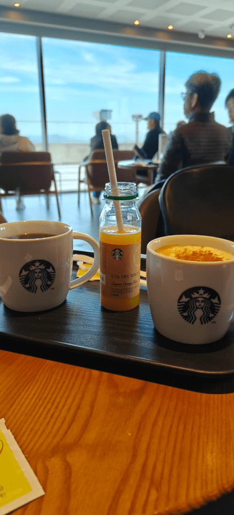
As we entered the Starbucks to look for a place to sit, the atmosphere was calm and welcoming, a stark contrast to the location where we were standing otherwise. The baristas greeted visitors in both Korean and English. The action, though, was in the chilly weather outside with tourists glued to the binoculars and camera looking at the DPRK. An occasional farmer on the fields, dried fields, building, roads, just about everything which would otherwise seem normal was suddenly special. A quick order of coffee and desserts before heading out to get the first real glimpse of the DPRK, often called the hermit kingdom. The river flowing slowly acting as the border, a tour guide talking about propaganda in a tone which sounded like propaganda, the binoculars moving to see various sights in the north was surreal. As I took the steaming cup in hand while watching DPRK, I noticed the security bunkers on top of the Starbucks as well as below the observation area, but my mind took me back to a book where the author crossed over to China and started crying after seeing the pet dog eating a bowl of rice, which was a rarity to find in DPRK. Here we were with Starbucks coffee in hand and watching the yellow fields of North Korea, some villagers and military men out on the roads and buildings which the South Korean called a propaganda village but in reality no one knows what it is.
The view was wide and cinematic. Flat farmlands, low-rise structures, clusters of trees, a landscape frozen in time. No traffic, no city skyline with the silence broken by a South Korean guide who wants to compare the North with the South in terms of industrialisation. We clicked pictures with the DPRK as the background, and when the novelty wore out and I got back to my senses to start my role as a guide to TW and TD, explaining TD about the two Koreas in simplest terms and TW the whole war, how it ended, where it ended and how the borders were redefined later. TW is kind enough to listen to the stories of various geopolitical events from me and kinder to say that she has learnt more history and geography from me than the text books have ever taught. From the palace of Versailles where the treaty to end the first world war was signed to the Berlin wall and the closed doors of the Kremlin in the world war era, along with the Vietnam and Korean wars, I have been the eternal guide over the last 15 years.
As people clicked more pictures to post with hashtags like DMZView, I kept wondering at how things were frozen just across the river. Google maps was bugged, possibly due to GPS jamming and the map clearly wasn’t taking my location correctly. Through the lens, I watched as a few people carried bundles of hay — small but vivid signs of life amid the silence.
The visit to the Starbucks at the DMZ wasn’t just about the coffee. It was about standing on the edge of two worlds, witnessing the stark divide, and contemplating the human stories that lie on either side of that invisible line. It was a reminder of the fragility of peace, the persistence of division, and the bizarre ways in which our globalized world sometimes intersects with the most geopolitically charged landscapes. One day, I wish to write from the other side of the border and see South Korea from the North. It is already difficult to believe that I was alive when the Berlin wall fell and the Soviet Union collapsed or when Yugoslavia broke up, so I would say “Never say Never”, but TW would always say “Never”.